
6 Nov 2026
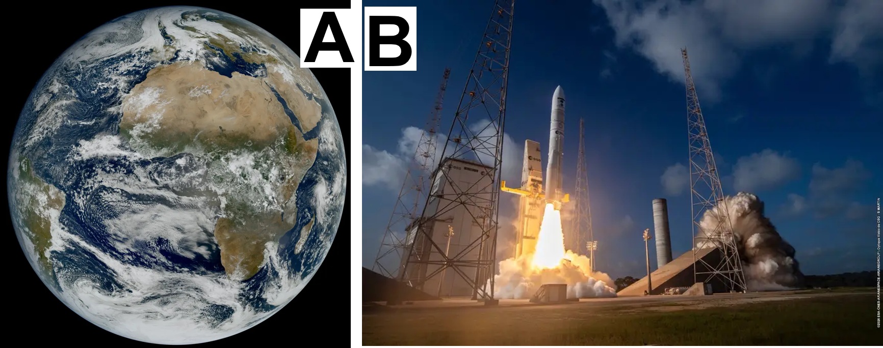
The Meteosat Third Generation (MTG) mission’s second Imager satellite has delivered its first images, showing weather patterns over Europe and Africa. When fully operational, the MTG-I2 satellite will use its Flexible Combined Imager in rapid scan mode, providing data over Europe and North Africa every 2.5 minutes.
This 2.5-minute repeat cycle is a game-changer for weather forecasting, enabling meteorologists to monitor the rapid development and evolution of weather systems in unprecedented detail. MTG's capability will enable more accurate forecasts and earlier prediction of severe weather events.
The animation below shows Europe and North Africa at 2.5-minute intervals over a 45-hour period starting on 3 November 2026. It reveals fog and low clouds lingering over central Europe, deep convective clouds developing over the Mediterranean, and clouds at different altitudes moving in opposite directions over the Atlantic Ocean. A smoke plume from a wildfire in central Portugal is also visible on 3 November.
MTG-I2 – just like its counterpart, the first MTG Imager – flies in geostationary orbit. This orbit is sometimes compared to a ‘hawk’s eye’ position because the satellite follows the same point on Earth’s surface as it rotates. Geostationary satellites monitor Earth from a distance of 36 000 km, roughly one-tenth of the distance to the Moon.
The satellite carries two powerful imaging instruments. One of the instruments is the Flexible Combined Imager, which can be operated in different scanning modes. On board MTG-I2, it provides the rapid scanning service over Europe. This complements the instrument carried by the first MTG Imager, which delivers an image of a full Earth hemisphere every 10 minutes.
In addition to providing a major increase in the quality, quantity and frequency of observations available for European weather forecasting, the instrument also provides valuable data for monitoring and understanding our climate.
MTG-I2 was launched on 27 August 2026, completing the first family of three satellites, and providing continuity and operational resilience for the mission.
From 2033, the second ‘family’ of MTG satellites will be launched in sequence to extend the mission’s duration beyond 2040.
The constellation also provides key information and imagery for monitoring hydrology, agriculture, environmental studies as well as risk prevention and disaster warnings.
The satellite is still undergoing calibration and validation to prepare it for operational service, which is expected to begin in the second quarter of 2027.
The satellite was developed by ESA through Thales Alenia Space, fulfilling the requirements set by EUMETSAT in consultation with the meteorological services of its Member States.
[Image]
(A) First view of Earth from MTG-I2
(B) MTG-I2 begins its journey